|
City seeks input as transportation planning gets
underway |
|
January 29, 2018 |
 |
| The online
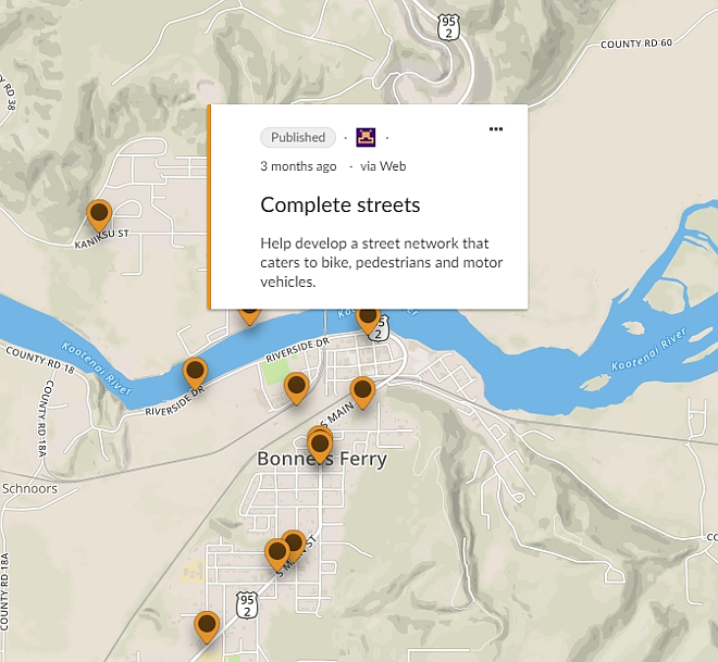
The Bonners Ferry Transportation Plan
Input Map is an interactive way of
learning what planners are thinking as
they begin working on the city
transportation plan and of sharing your
thoughts on what is needed to improve
getting around in your neighborhood. |
|
The City of Bonners Ferry is developing a plan
for all types of transportation throughout the
city, and city residents are being asked to
contribute in two important ways; by taking a
short survey, and by going to an interactive
map, viewing what is currently being considered
and giving your comments on what would improve
all modes of transportation in your
neighborhood.
This plan, once complete, will greatly improve
Bonner Ferry’s chance of receiving federal
funding and grants for needed transportation,
bicycle and pedestrian facility improvements.
Funding agencies carefully review these plans
when considering future projects.
The
Bonners Ferry Transportation Survey asks 11
transportation-specific questions and is a
critical part of the process of setting clear
priorities and gathering public input to
determine appropriate steps the City should take
to benefit the community. It consists of 11 is
intended to gather information from the public
on the use and design of city streets and
pathways.
This survey will not be used to inform Idaho
Transportation Department on improvements
related to Highway 95.
The
Bonners Ferry Transportation Plan Input Map
enables residents to provide street specific
comments regarding the city’s infrastructure
and/or additions they’d like to see.
The survey asks for your name and contact
information should planners have further
questions, but there is no requirement on either
to provide your personal information. Either
way, the information received from both public
outreaches will become an integral part in
shaping the city’s transportation planning
effort. |
|
Questions or comments about this
letter?
Click here to e-mail! |
|
|
|
|

